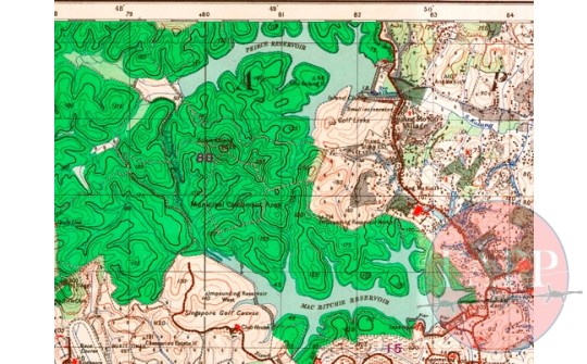
1938 OS Map of the Battlefield between the reservoirs P.84
Item Information:
Catalogue Number: Maps 010 Source: National Library of Australia Location: MacRitchie Report No: Not Applicable Artifact Type: Map Production Date: 2016-04-15 00:00:00 Dimensions of Item: Copyright with Source Institution
Other Description:
A close up of the 1938 OS map of Singapore showing the area between Pierce and MacRitchie Reservoirs
Historic Context:
It was into this area that FewForce was asked to patrol on the 12th of February 1942. They moved from Thomson Village up to the Tiang Guan Estate before heading west towards the highest peaks of Bukit Kalong. They then moved on towards the pipeline and track running between the end of Pierce and MacRitchie reservoirs. They then dug in overlooking the track. Patrols were sent north towards the shores of Pierce and along the southern road bordering the golf course and towards Bukit Tingii. Both patrols ran into opposition but engaged without losing a man.


Comment Here:
Your email will not be published. Required fields are marked *
Related Items:
A Collection of Images of MacRitchie Reservoir Nature Reserve P83
Various
1928 OS map of Bukit Timah p78
National Library of Australia